Navigating the seas
For centuries, sailors would look to the stars to find their position and sail the seven seas. Today, sailors rely on these traditional navigational techniques as a backup to modern technology.
Last updated 22 July 2025
Techniques
Finding the North Star
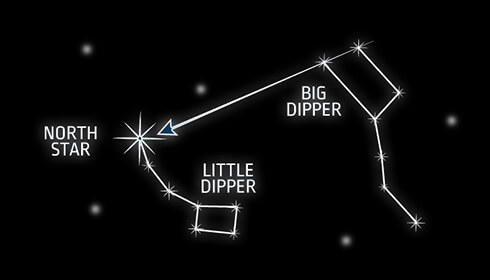
Here’s a tip that you can even use on land. The North Star (Polaris), located at the end of the Little Dipper constellation, always points north. To locate Polaris, use the Big Dipper. The two outermost stars of the Big Dipper forms a line that points to Polaris.
Using a sextant
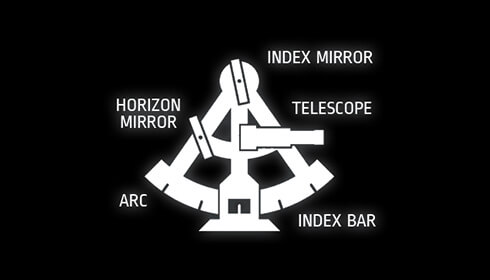
A sextant allows you to measure the angle between two celestial objects or between one object and the horizon, allowing you to find your position out in the open sea.
Paper charting
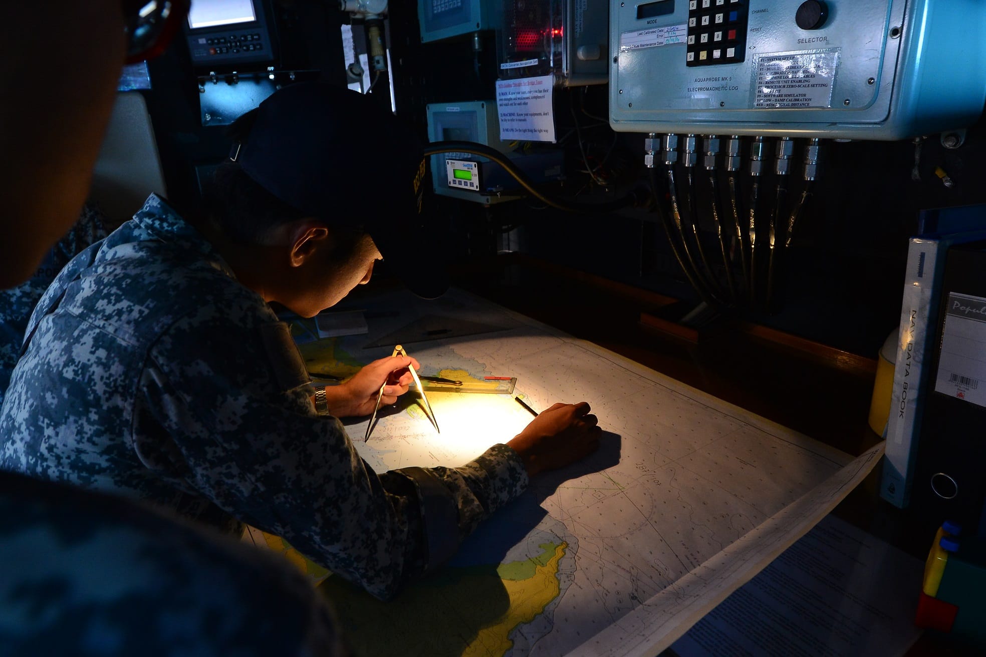
Paper charting is a fundamental navigational skill that has existed in the nautical domain for centuries. This involves the use of traditional nautical charts and navigational tools such as compasses, dividers and rulers to plot courses.
Tools
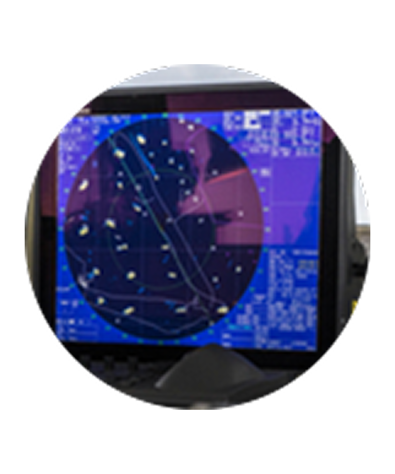
1970s GPS
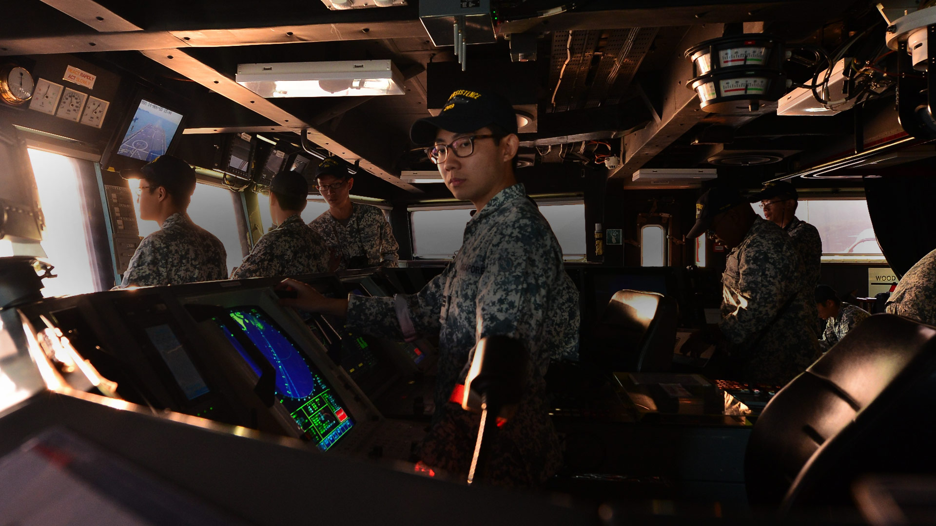
Global Positioning System (GPS) is the fastest and most accurate form of navigation currently available, allowing seamen to pinpoint their position and the location of other vessels, and track the speed or direction of movement of other ships.
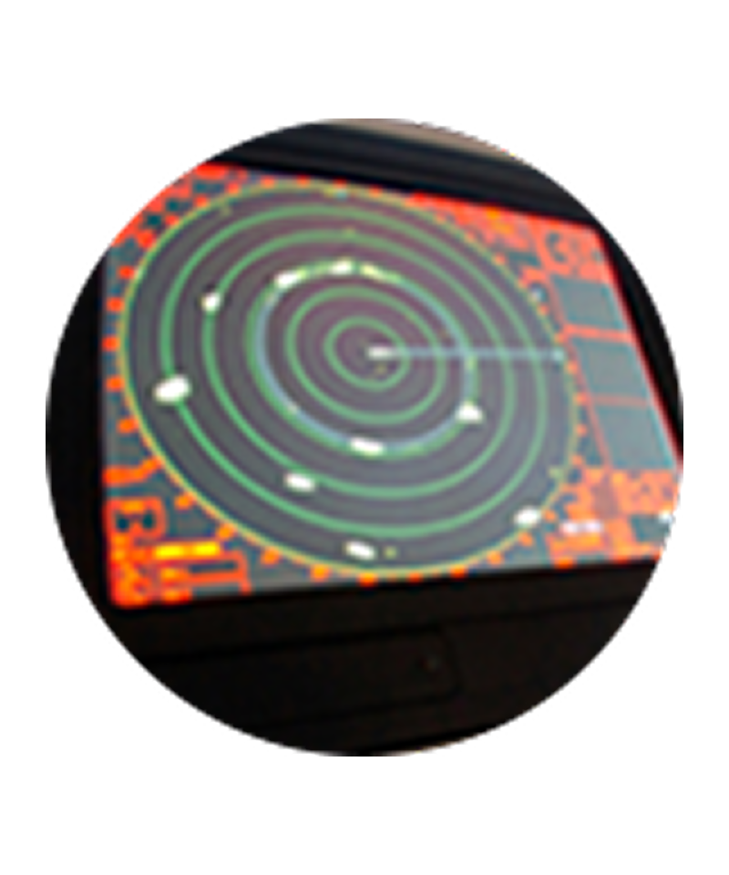
1930s Radar
This technology relies on radio waves to detect ships and aircraft, and allows ships to navigate even when visibility is poor. Early versions were much less accurate than the high-tech models available today.
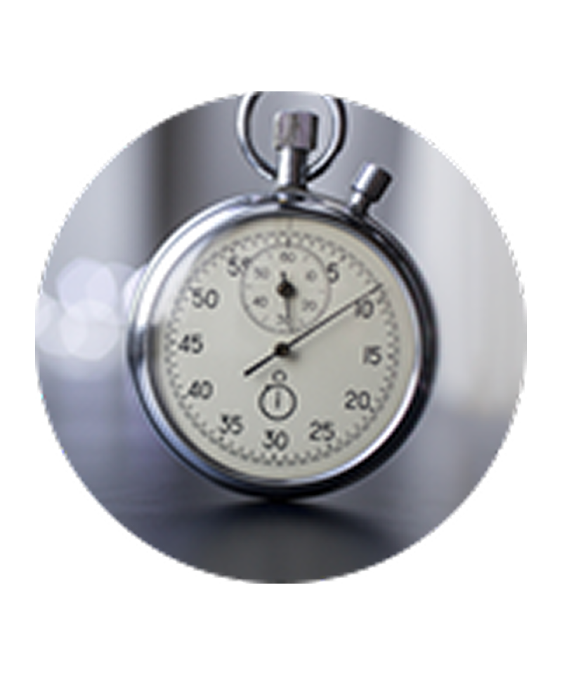
18th Century Chronometer
The marine chronometer is a very precise, accurate timepiece that can be used to determine longitude based on the position of the stars in the sky, which can vary according to the time of day and the season.

17th Century Sextant
A tool that allows the user to measure the angle of a star from the horizon. The sextant is easy to use in theory, but takes some skill and practice to use properly. A small error could result in a ship being dangerously off course.
Terms
Bearing
The bearing is the direction of an object from one’s own vessel, expressed in degrees.
1 Knot
Approximately 1.852 kilometres per hour.
Port and starboard
Port and starboard refer to the left and right side of the ship respectively. Back in the day, cargo was loaded from the left (or ‘port’ side) when in port, and the steering rudder was fixed to the right (or ‘starboard’ side, which literally means the side which the ship was steered).
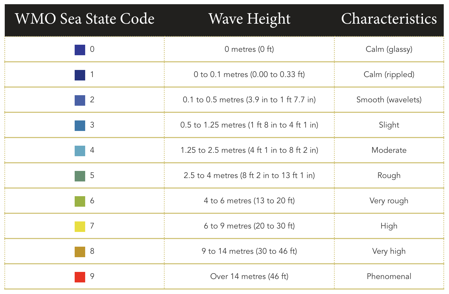
Sea state
Sea state refers to the condition of the sea. Sea state ranges from 0, which is calm (glassy), to 9, which is phenomenally rough with high waves.
WMO Sea State Code and corresponding wave height and characteristics
WMO Sea State Code | Wave height | Characteristics |
|---|---|---|
0 | 0 metres (0 ft) | Calm (glassy) |
1 | 0 to 0.1 metres (0.00 to 0.33 ft) | Calm (rippled) |
2 | 0.1 to 0.5 metres (3.9 in to 1 ft 7.7 in) | Smooth (wavelets) |
3 | 0.5 to 1.25 metres (1 ft 8 in to 4 ft 1 in) | Slight |
4 | 1.25 to 2.5 metres (4 ft 1 in to 8 ft 2 in) | Moderate |
5 | 2.5 to 4 metres (8 ft 2 in to 13 ft 1 in) | Rough |
6 | 4 to 6 metres (13 to 20 ft) | Very rough |
7 | 6 to 9 metres (20 to 30 ft) | High |
8 | 9 to 14 metres (30 to 46 ft) | Very high |
9 | Over 14 metres (46 ft) | Phenomenal |